


News

Weather
Posted: May 06, 2024 9:45 AMUpdated: May 06, 2024 1:23 PM
High Risk for Severe Weather Increases Monday Evening


CLICK HERE TO SIGN UP FOR K-1 TEXT SEVERE WEATHER ALERTS
The risk of severe weather increases late Monday evening through the overnight hours.
Thunderstorms are expected to develop across central Oklahoma late Monday afternoon and spread into eastern Oklahoma and southeast Kansas during the evening. Severe weather is expected with these storms, along with the potential for significant severe weather across parts of eastern Oklahoma and southeast Kansas.
The western half of Osage County and Chautauqua County in Kansas are in a high risk area (Level 5 of 5) for severe weather. Eastern Osage County, Washington County and Nowata County; as well as Montgomery County and Labette County in Kansas are in a moderate risk area (Level 4 of 5).
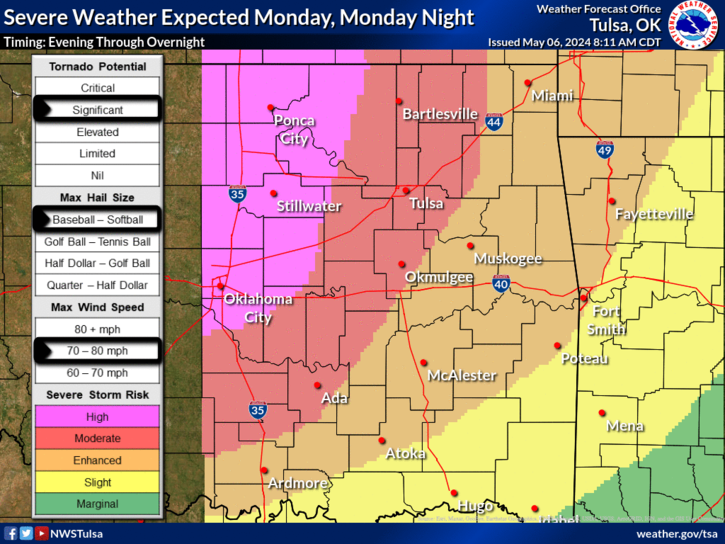
Long track, violent tornadoes, very large hail up to the size of softballs are possible with the strongest storms. The most likely time for severe weather in the listening area is between 7 p.m. Monday and 2 a.m. Tuesday, but could begin as early as 5 p.m.

The National Weather Service encourages everyone to continue to monitor reliable sources of weather information, and make sure you have multiple ways to receive warning information, including methods that are designed to wake you up.
« Back to News