


advertisements


News

Weather
Posted: May 23, 2025 6:32 AMUpdated: May 23, 2025 6:41 AM
Flood Watch For The Holiday Weekend


National Weather Service / Tom Davis
Bartlesville Radio is here to prepare you, not scare you. When severe weather is in the forecast, Bartlesville Radio is here to keep you ahead of the storms.
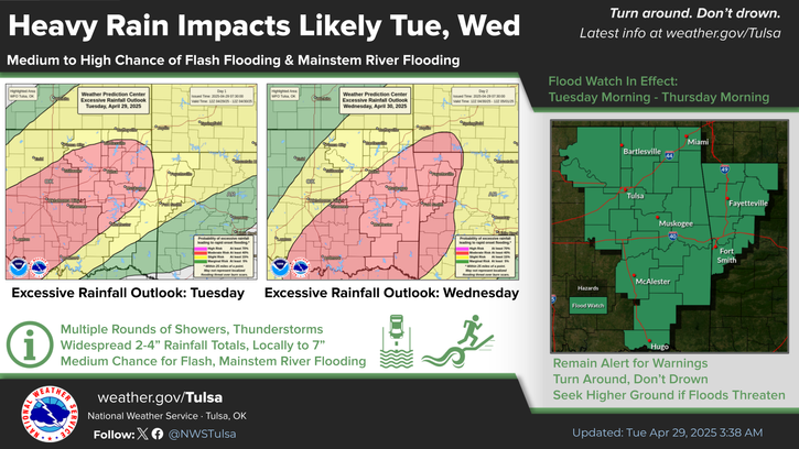
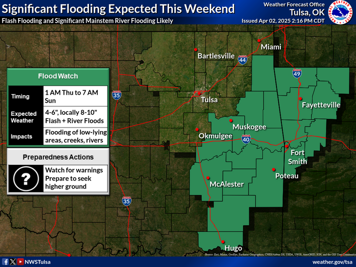
Due to the expected heavy rainfall this weekend, a Flood Watch is in effect early Saturday through Monday for areas near and north of Interstate 40.
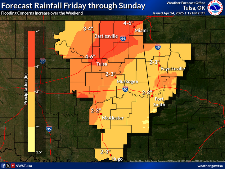
Several rounds of storms through the weekend will not only bring some severe weather chances, but will also bring heavy rainfall with increasing flash flood and mainstem river flooding potential. The heaviest rain is expected to fall from Saturday into Monday across parts of northeast Oklahoma and northwest Arkansas where 4 to 6 inches of rain and locally higher than 8 inches may occur through the 4 day period from today through Monday. Continue to monitor latest forecasts, especially those with outdoor activities this holiday weekend.
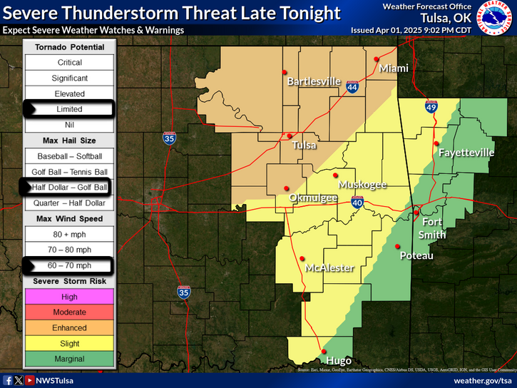
A few strong to severe thunderstorms will be possible this afternoon through tonight as one or more clusters of storms moves across the region. More thunderstorms are in the forecast for Saturday as a frontal boundary drops into the area. Large hail and damaging winds will be the main threat, along with heavy rainfall.
If you encounter flooded roadways, turn around, don't drown.

« Back to News