


advertisements


News

Weather
Posted: Mar 05, 2026 1:44 PMUpdated: Mar 05, 2026 1:48 PM
Severe Weather Threat Increases Thursday Night, Friday Afternoon/Evening


Nathan Thompson
Weather conditions are developing to possibly support strong to severe thunderstorms across the region during the overnight hours Thursday and again on Friday.
Additional showers and thunderstorms are forecast to move into the region from the west late Thursday night and into Friday morning. There is a marginal to slight risk of severe weather including large hail, damaging wind gusts and a limited tornado potential.
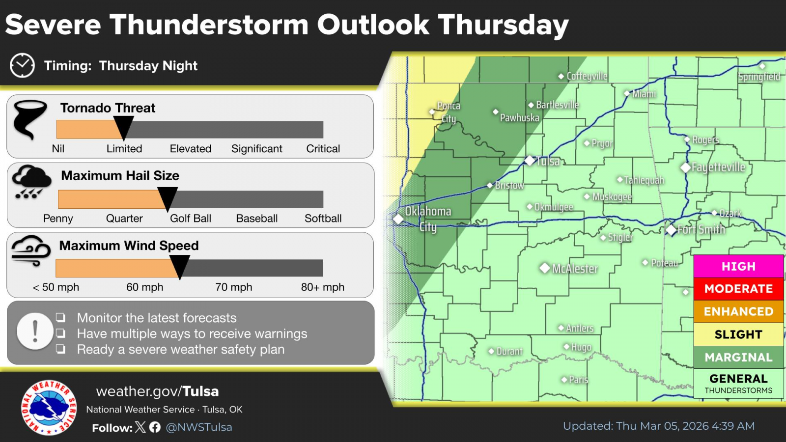
The severe risk during the overnight hours is a Level 1 of 5 from Ramona to the south and east, and a Level 2 from Bartlesville to the north and west. The severe risk increases to a Level 3 for far western Osage and Chautauqua counties.
.png)
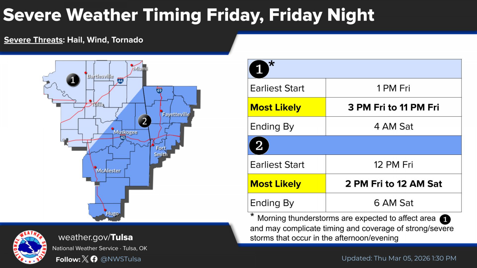
A higher likelihood of severe weather is possible late Friday afternoon into the evening hours.
News on 6 Meteorologist Stephen Neherenz has the latest.
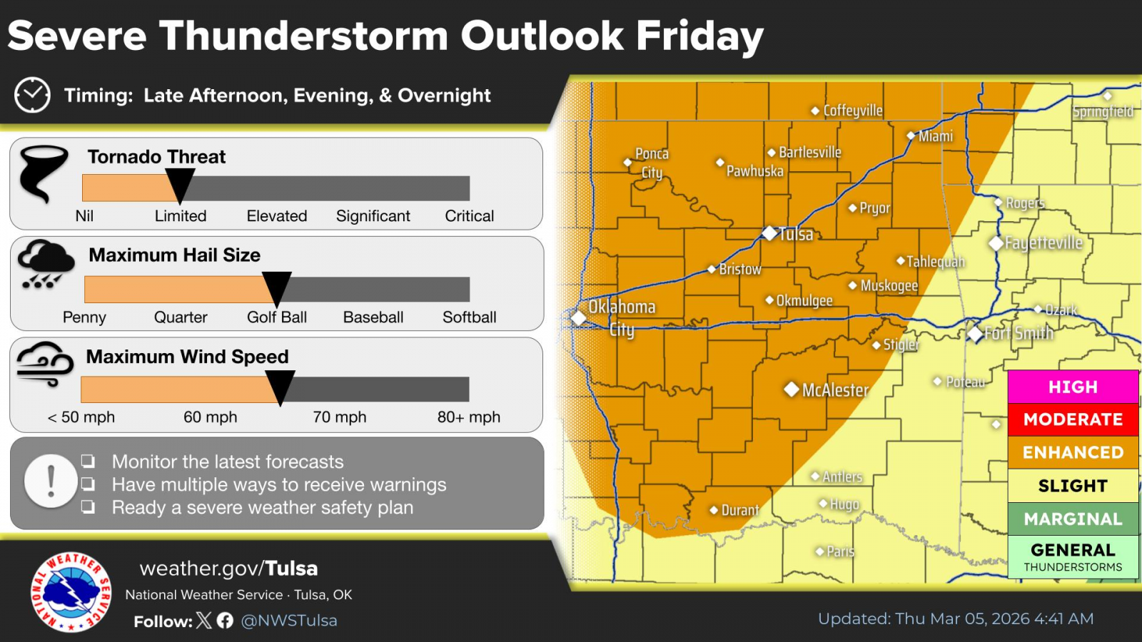
Shower and thunderstorm chances increase again as another cold front pushes into the region. Instability ahead of the front will create a potential for severe storms across the listening area. A Level 3 of 5 severe weather risk exists with all modes of severe weather possible, including golf ball-sized hail, damaging wings and tornadoes.
Stay with Bartlesville Radio for the latest weather information. We are here to keep you ahead of the storm, to prepare you — not scare you.
« Back to News