


News

Weather
Posted: Mar 31, 2025 2:47 PMUpdated: Apr 01, 2025 1:53 PM
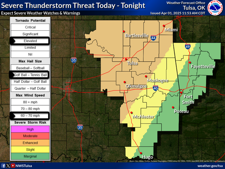
Severe Weather Risk at Level 3 of 5 Tuesday, Wednesday


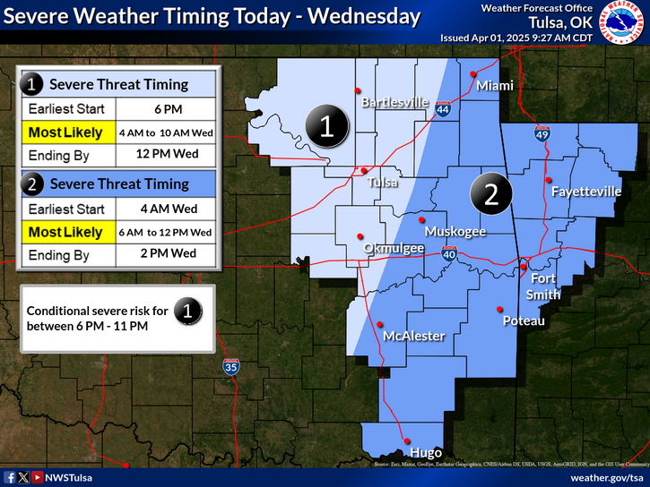
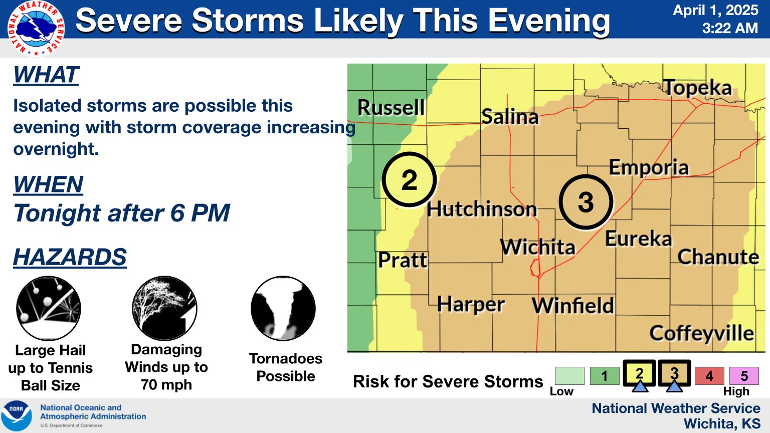
Two rounds of severe weather are possible. First, a dry line is expected to form ahead of a cold front in northeast Oklahoma and southeast Kansas mid-evening Tuesday. However, there will be a strong atmospheric cap that will hinder storm development. If the cap breaks, the environment will be supportive of supercells capable of very large hail, damaging winds and tornadoes.
The second round of thunderstorms are likely during the overnight hours and into Wednesday morning along the frontal boundary, forming a “squall line” of severe storms. The instability is expected to support damaging straight-line winds, some hail and a limited risks of tornadoes.
As always, we will broadcast live reports of severe storms when they happen. Sign up for K-1 Weather Text, download the Bartlesville Radio app on your smart phone and have a battery-powered radio ready tuned to your favorite Bartlesville Radio station.
We are here to prepare you, not scare you.
Additionally, a Wind Advisory is in effect for our Oklahoma listening area until 4 a.m. Wednesday and Chautauqua County, Kan. until 1 a.m. Wednesday. Wind gusts up to 45 mph will continue during this time.
« Back to News