


advertisements


News

Weather
Posted: Jun 04, 2024 2:53 PMUpdated: Jun 04, 2024 2:53 PM
Slight Risk of Severe Weather Tuesday Night

Nathan Thompson
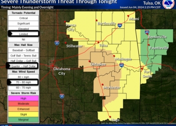
The listening area is under a slight risk (Level 2 of 5) for severe weather late Tuesday night into the early morning hours Wednesday.
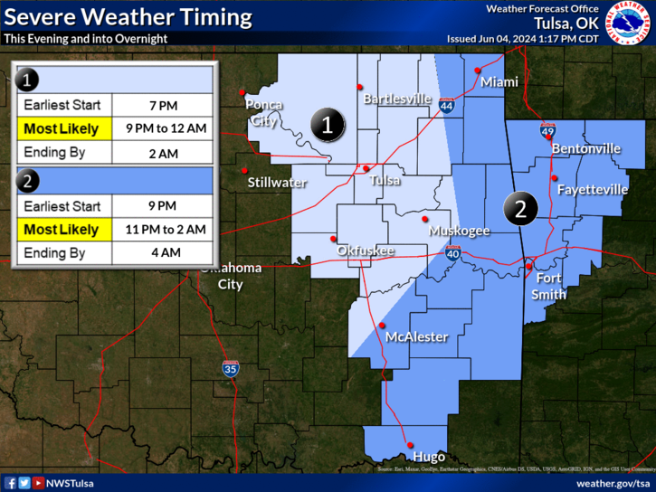
The National Weather Service says storms are expected to form in western Oklahoma and Kansas Tuesday evening and will likely form into a complex as they move east-southeast across the area Tuesday evening and overnight.
The higher threat area is south of the Tulsa area, from Oklahoma City to McAlester. The weather service says a low tornado threat will be in place, though damaging winds will be the primary threat with isolated straight line wind gusts between 70-80 mph possible.
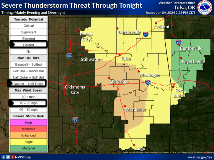
Large hail will be a secondary threat. Additionally, locally heavy rainfall will likely accompany the stronger activity and may lead to flash flooding and flooding of main stem rivers, especially in southeast Oklahoma.
The weather service says the most likely timing for storms in the Bartlesville area is between 9 p.m. and midnight.
« Back to News