


advertisements


News

Weather
Posted: Jun 12, 2026 3:27 PMUpdated: Jun 12, 2026 3:27 PM
Severe Weather Risk Increases for Saturday PM

Nathan Thompson
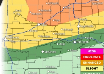
Severe weather risks are increasing for Saturday afternoon into the evening and overnight hours across northeast Oklahoma and southeast Kansas.
A Level 3 of 5 risk zone includes most of the listening area from Pawhuska to the east and downtown Tulsa to the north.
Thunderstorms are expected to develop along a front near the Kansas border Saturday afternoon, with one or more clusters likely to move south and east across the region Saturday night. These storms will pose a risk for severe weather, with damaging winds and hail the main threats.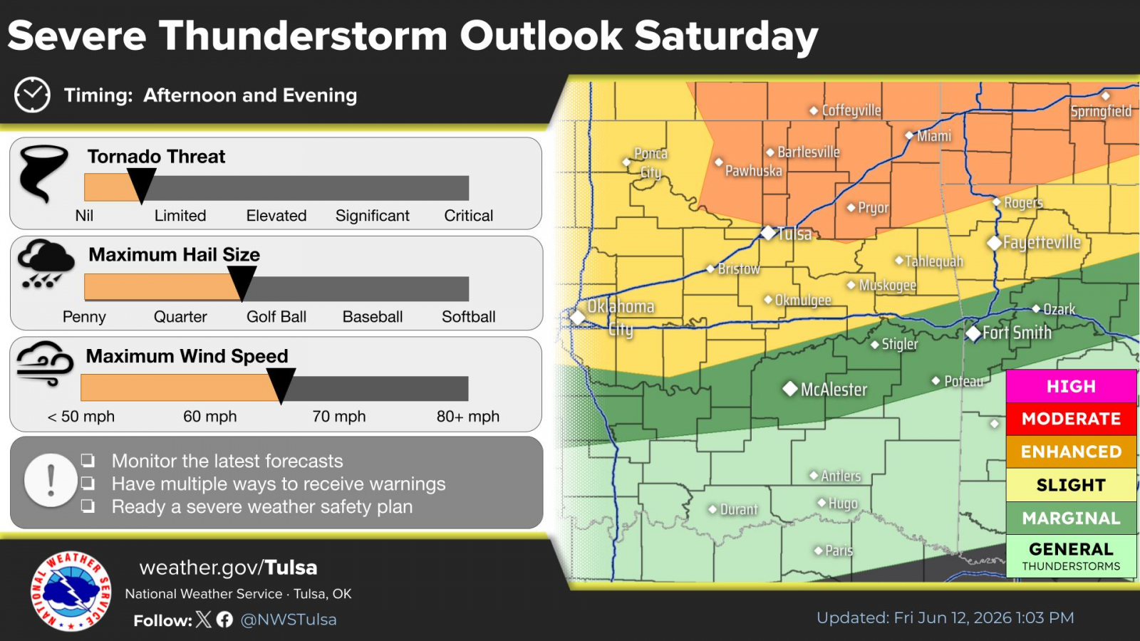
Storms developing on the front will bring a slight risk of excessive rainfall which could lead to flash flooding mainly late Saturday into Saturday night. The risk shifts to the south and east by Sunday.
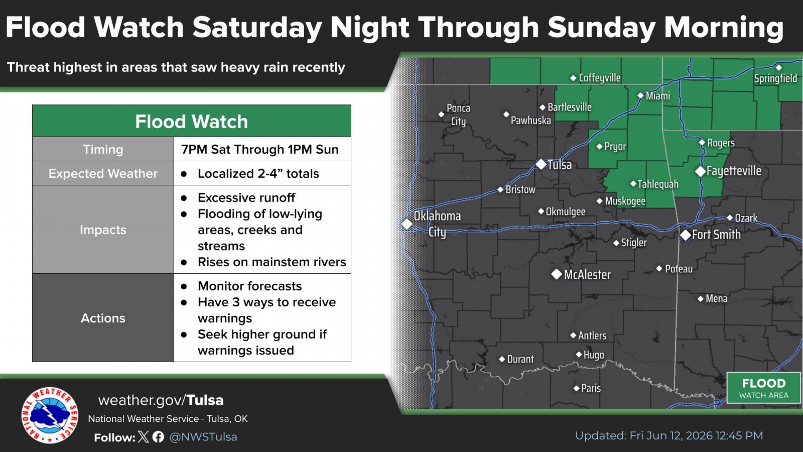
A Flood Watch has been issued for heavy rain potential from Saturday night through Sunday morning. Locations in the watch area include Nowata County in Oklahoma and Chautauqua, Montgomery and Labette counties in Kansas. Widespread rain totals of one to two inches with localized totals of two to four inches will be possible in the watch area.
« Back to News