


advertisements


News

Weather
Posted: Sep 22, 2025 1:27 PMUpdated: Sep 23, 2025 9:51 AM
Severe Weather Threat Increases During Overnight, Tuesday Morning Hours


Nathan Thompson
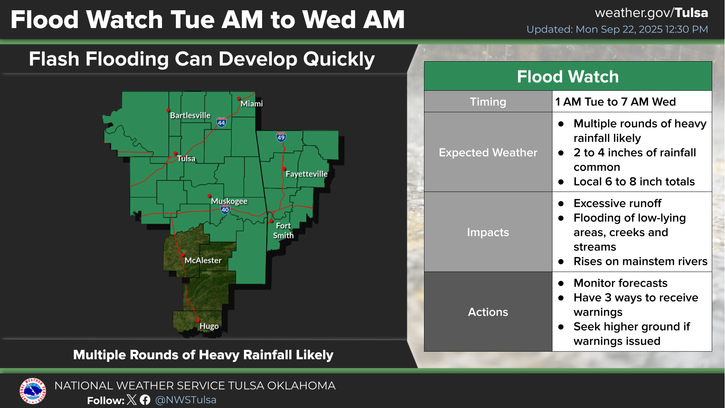
Multiple rounds of showers and thunderstorms with heavy rainfall potential are likely from early Tuesday morning through daybreak Wednesday morning with a level 2 out of 5 risk for severe weather in the Bartlesville area.
News On 6 Meteorologist Stephen Nehrenz has the latest.
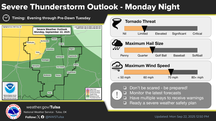
Severe weather will be possible in the listening area with a storm complex approaching from the west Monday evening and overnight. Strong winds will be the primary threat, but all hazards will be possible with this activity. The chance of severe weather with this complex will be highest in areas along and west of Highway 169 and along and north of I-44, with a trend toward lower intensity farther south and east.
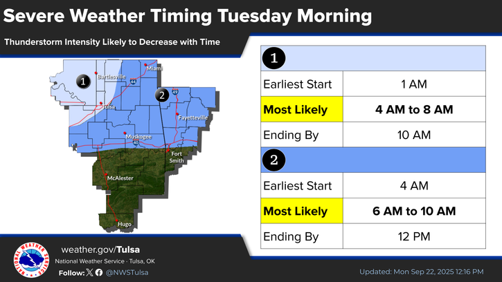
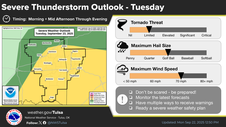
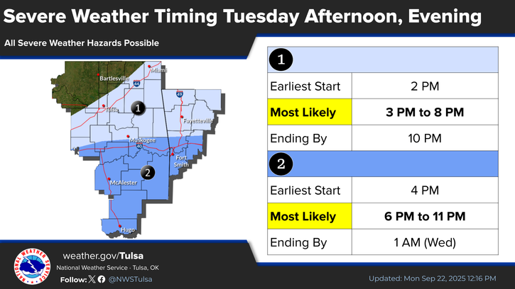
Additional rounds of severe storms will be possible on Tuesday, first with a complex moving through the region during the morning hours. Then, additional thunderstorm development Tuesday afternoon and evening will bring the highest threat for severe weather with all hazards possible. The Bartlesville region is in a level 1 of 5 area and a level 2 from Tulsa to the south and east.
Rainfall totals of 2 to 4 inches will be common, with localized totals from 6 to 8 inches possible. These rainfall amounts may lead to flash flooding, as well as rises on rivers.
A flood watch is in effect until 7 a.m. Wednesday.
« Back to News