News
Weather
Posted: Nov 03, 2024 4:32 AMUpdated: Nov 03, 2024 4:34 AM
Sunday 5am Weather Update with Rain Totals and Lake Levels

Flood Watch in Effect for Eastern Oklahoma Through Monday Afternoon
255 AM CST, Sunday, November 3, 2024
Residents of eastern Oklahoma are under a flood watch through Monday afternoon as heavy rainfall is expected to continue across the region. The National Weather Service (NWS) has issued the alert due to the potential for excessive rain, which could lead to flooding in low-lying and flood-prone areas.
Affected Areas
The flood watch affects several counties across east-central, northeast, and southeast Oklahoma, including:
- East Central Oklahoma: Cherokee, Muskogee, and Okfuskee counties
- Northeast Oklahoma: Craig, Creek, Delaware, Mayes, Nowata, Okmulgee, Osage, Ottawa, Pawnee, Rogers, Tulsa, Wagoner, and Washington counties
- Southeast Oklahoma: Haskell, McIntosh, and Pittsburg counties
Rainfall and Flooding Risks
The region is expected to experience multiple rounds of heavy rain, with widespread accumulations of 3 to 7 inches. Localized areas may see even higher totals. This excess rainfall may cause rivers, creeks, and streams to rise rapidly, creating hazardous conditions in flood-prone areas.
Preparedness and Safety Tips
The NWS urges residents to monitor updates on the weather and be prepared to take action if flooding develops. Those living in flood-prone areas should have an evacuation plan ready and stay alert for possible flood warnings.
For additional information and safety tips, visit the NWS flood safety page: www.weather.gov/safety/flood.
Precautionary Steps:
- Avoid driving on flooded roads.
- Move to higher ground if you are in a flood-prone area.
- Stay informed by checking local forecasts and weather updates.
The situation is being monitored closely, and further updates will be provided as necessary.
The Weather Stats for 5am Sunday, November 3, 2024:
Rain:

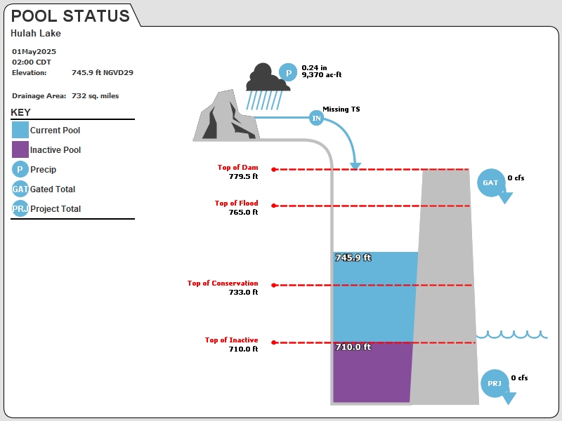
Hulah Lake:

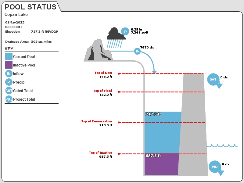
COPAN LAKE:

« Back to News


