News
Weather
Posted: Apr 30, 2024 1:16 PMUpdated: May 01, 2024 9:39 AM
Flood Watch in Effect Until Wednesday Morning

Nathan Thompson
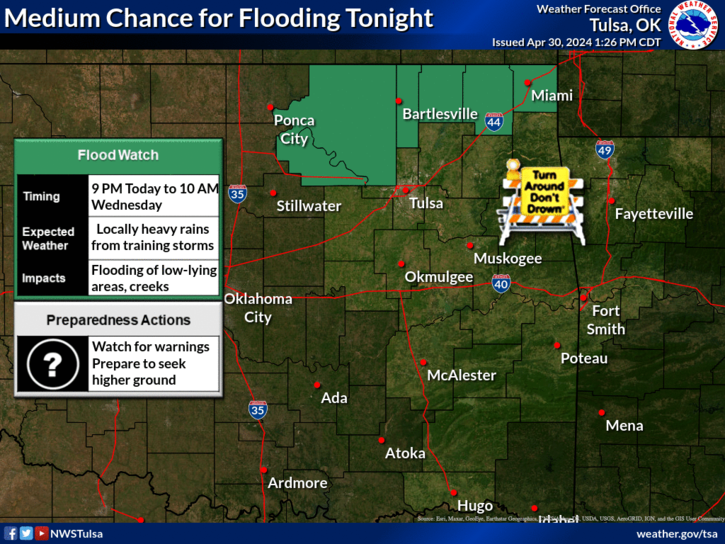
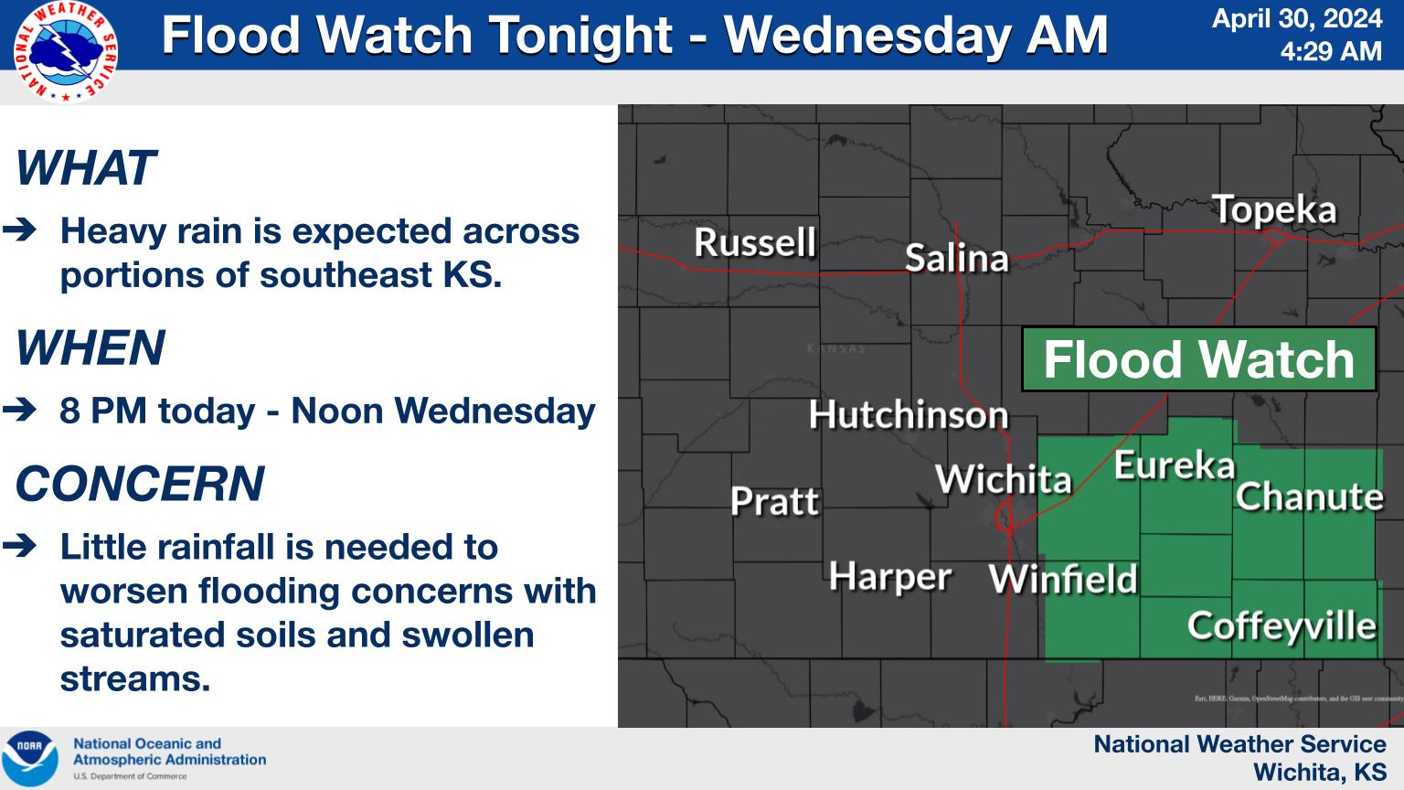
A flood watch is in effect for the listening area through Wednesday morning.
The National Weather Service issued the watch from 9 p.m. Tuesday until 10 a.m. Wednesday for Osage, Washington, Nowata, Craig, Ottawa and Pawnee counties in Oklahoma and from 8 p.m. Tuesday until noon Wednesday for Chautauqua, Montgomery and Labette counties in Kansas.
Showers and thunderstorms are expected to develop Tuesday evening along a frontal boundary slowly moving into the region. Potential exists for training of storms along and near the Oklahoma-Kansas border through the overnight hours over already saturated areas.
The weather service says rainfall of 1 to 3 inches will be common, with locally higher amounts of 4 to 5 inches possible. Excessive runoff may result in flooding of rivers, creeks, streams, and other low-lying and flood-prone locations.
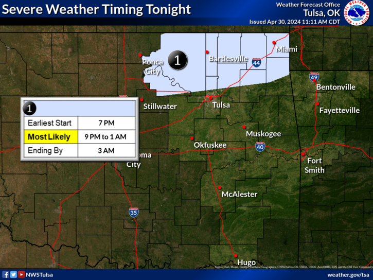
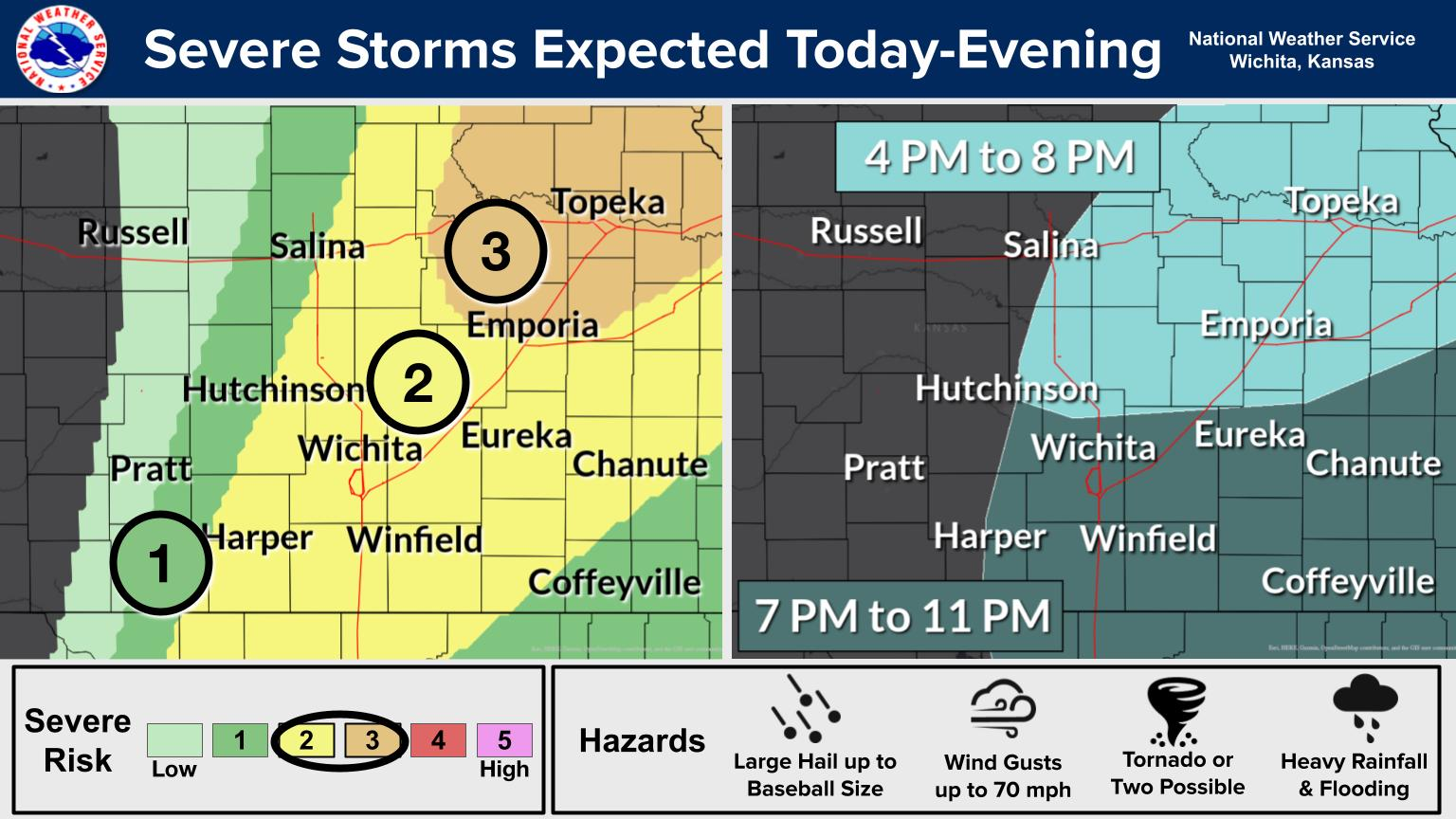
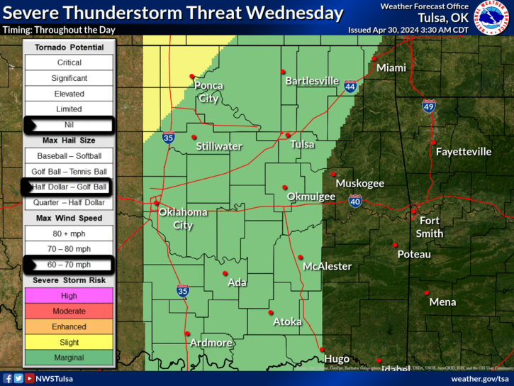
Thunderstorms that develop tonight to the north may become severe Tuesday evening and into the overnight hours across parts of northeast Oklahoma and southeast Kansas. Large hail and damaging winds will be the main threats.
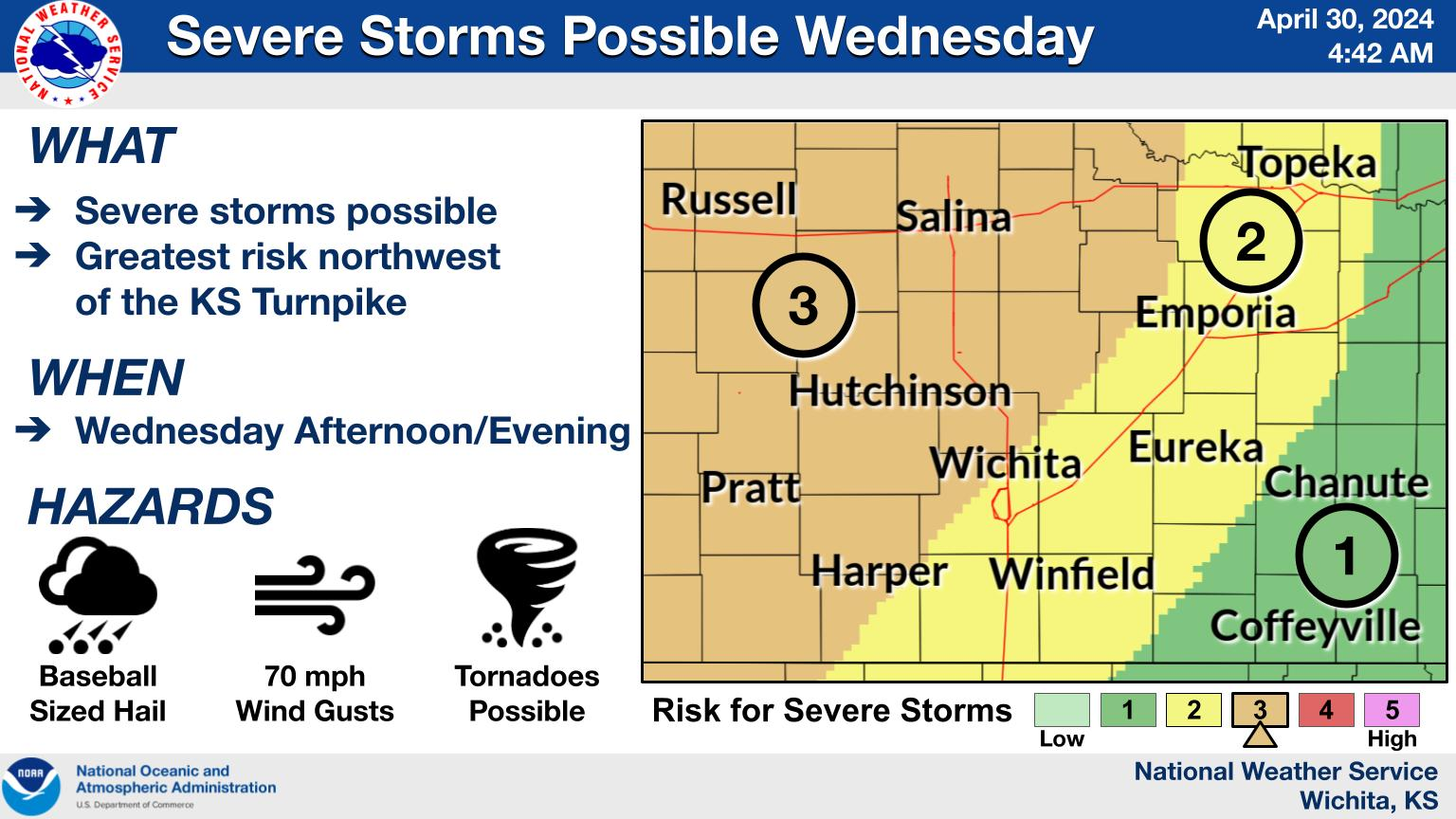
Additionally, isolated storms are expected to develop on the dryline Wednesday afternoon to our west. A few of these storms could move into eastern Oklahoma and Kansas during the late afternoon or evening hours. Any storm that develops would have a good chance of become severe with large hail and spotty damaging wind the main threats.

« Back to News


